Lewis & Clark NRD Puts Flood Resiliency to the Test
Lewis & Clark NRD Puts Flood Resiliency to the Test
Northeast Nebraska Flood Infrastructure Saves more than $1.3 million in Damages
LINCOLN, Nebraska – A turbulent week of weather in northeast Nebraska put flood control systems to the test—and in Dixon County, those systems passed with flying colors.
Between July 9-11, 2025, northeast Nebraska endured another round of severe weather triggering a tornado watch, a flood advisory, and multiple severe thunderstorm warnings. Powerful storms dumped nearly four inches of rain across Dixon County making conditions ripe for flash flooding, erosion, and infrastructure strain.
But thanks to decades of thoughtful investment and infrastructure planning, Lewis & Clark Natural Resources District’s Aowa Creek Watershed flood control structures did exactly what they were designed to do—protect lives, property, and the future.
The morning after the storm, the U.S. Department of Agriculture’s Natural Resources Conservation Service (USDA-NRCS) DamWatch Software issued threshold exceedance alerts for numerous Aowa Creek Watershed structures. However, the Lewis & Clark NRD was already ahead of the curve. General Manager Annette Sudbeck and her team were in the field early that morning, proactively inspecting dams, monitoring site conditions, and ensuring the safety of downstream communities.
Despite the intense rainfall, no auxiliary spillways were observed flowing, and the system held firm.
“This storm is exactly the kind of event these structures were built for,” said Sudbeck. “The flood control dams performed exactly as intended. By temporarily detaining runoff water and releasing it in a controlled manner we can reduce downstream flood damage.”
In total, the 48 Aowa Creek Watershed structures received significant rainfall and worked in concert to prevent major flooding. Together, these structures are capable of temporarily detaining more than 7,000 acre-feet of floodwater—water that is safely stored and released at a controlled rate over time. According to USDA-NRCS, the estimated benefits of these structures during the July 9-11, rainfall event were more than $1.3 million—including $896,000 in flood damage reduction and $488,000 in non-flood benefits such as erosion control and sediment retention.
One of the key elements of the flood reduction infrastructure in northeast Nebraska is an extensive network of PL-566 watershed structures. The Watershed Protection and Flood Prevention Act, often referred to as PL-566, authorizes USDA-NRCS to help local organizations and units of government plan and implement watershed projects.
The Aowa Creek flood infrastructure was developed in response to persistent flooding issues in the region, particularly for the communities of Newcastle and Ponca. Completed in the 1970s through the early 2000s, the project includes flood retarding and grade stabilization dams across more than 55,000 acres of drainage area. Two of these structures, Buckskin Hills and Powder Creek, are managed as public Wildlife Management Areas.
“The proactive measures and robust engineering of the flood protection systems played a crucial role in minimizing the impact on local communities,” said Allen Gehring, USDA-NRCS state conservation engineer. “The larger watershed contains a network of infrastructure that minimized the overall flooding from the Aowa Creek and its tributaries.”
Beyond flood protection, the project delivers long-term benefits in erosion control, sediment retention, wildlife habitat, and public recreation.
Throughout the state, Nebraska’s NRDs have utilized this federal funding and worked in partnership with USDA-NRCS to build and maintain flood reduction infrastructure.
According to the Federal Emergency Management Agency, for every dollar spent on flood mitigation, an average of $6 can be saved in post-disaster recovery costs.
The Lewis & Clark NRD continues to build on its long-standing commitment to flood resilience. For the past two years, the District has been working on a plan to upgrade two key structures located north of Highway 12 to enhance protection for downstream areas. These proposed plans for the structure upgrade are expected to be available for public review in winter 2025-2026. In addition, the Lewis & Clark NRD is developing a preliminary plan for new flood control practices or structures in the neighboring South Creek Watershed. These proposed improvements would help reduce erosion and provide added flood protection for the nearby communities of Ponca and Martinsburg.
The flood infrastructure in northeast Nebraska is a result of collaborative efforts between local, state, and federal partners, as well as engineering firms and community stakeholders. Through these partnerships, investments in flood mitigation continue to pay off today enhancing their overall effectiveness in the face of extreme weather events.
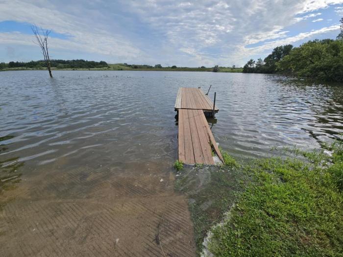
Water covers the dock at Buckskin Hills WMA southwest of New Castle, Nebraska, after a heavy rain in Dixon County.